Key Takeaways
- Drone and ground photos each contribute unique value to real estate listings in 2026.
- Combining both approaches can enhance your property’s visual impact and attract a wider range of buyers.
If you’re preparing to sell your home, understanding the role of drone versus ground photos can help your listing stand out.
What Are Drone and Ground Photos?
Defining drone photography
Drone photography uses small, remotely piloted aerial vehicles equipped with cameras to capture images from above. These photos provide perspectives you can’t achieve from ground level, such as bird’s-eye views of rooftops, yards, and the surrounding neighborhood.
Understanding ground-level photography
Ground-level photography, as the name suggests, involves taking photos while standing on the property. The photographer uses cameras on tripods or handheld to capture rooms, architectural details, and exterior features at eye level. These images show what buyers would naturally see when touring a home in person.
How Does Each Approach Work?
Drone photo process explained
Drone photography typically requires a licensed operator, especially in regulated airspace or near populated areas. The process starts with planning safe flight paths, checking weather conditions, and confirming the property’s legal eligibility for drone use. The drone’s camera is programmed to take panoramic, angled, or top-down photos, capturing the entire property and its setting.
Ground photo process explained
Ground-level photos rely on the photographer’s positioning and choice of lenses—wide-angle for interior rooms, standard for close-ups. A typical shoot covers front and back exteriors, all interior rooms, and unique features like gardens or pools. Preparation involves staging the space, setting correct lighting, and using stabilized equipment to avoid blurry photos.
What Are the Key Differences?
Angle and perspective
Drone photos offer sweeping, elevated views and reveal how the property fits into its surroundings—useful for showcasing large lots, nearby parks, or bodies of water. Ground photos provide a human-scale, immersive view, highlighting the property’s design, finishes, and functionality.
Technical equipment needed
For drone photography, you need a quality drone with a camera capable of high-resolution images, as well as knowledge of flight controls and basic airspace law. Ground photography uses a DSLR or mirrorless camera, occasionally complemented by flashes or portable lighting and sturdy tripods.
Common use cases in 2026
In 2026, drone photos are frequently seen in listings for single-family homes, estates, rural properties, and any location where land size or outdoor features matter. Ground photos remain essential for all listings—especially condos, townhomes, and smaller properties where drone shots add less context.
Which Photos Stand Out to Buyers?
Buyer reactions and trends
Recent surveys show that listings with both aerial and ground images receive 22% more online views. Buyers report feeling more confident about a home’s setting and layout after seeing a comprehensive photo set, as aerial shots answer questions about privacy, yard space, and neighborhood character.
Typical visual impact
Drone photos catch the eye in listing galleries—they’re often the first images buyers notice. These shots can suggest openness and prestige. Ground photos deliver detail and warmth, building emotional connection as viewers imagine themselves in the space.
Are There Benefits and Drawbacks?
Drone photo benefits and limitations
Benefits of drone photography include:
- Highlighting the scale of land and proximity to amenities
- Helping buyers understand property boundaries and outdoor features
- Creating a memorable first impression
However, drone use is subject to flight regulations and weather conditions and may not be allowed near airports or dense urban areas. It also adds cost and requires operator expertise.
Ground photo pros and cons
Advantages of ground photos are:
- Capturing interiors, finishes, and true-to-life home views
- Working in any weather and location, without regulatory limits
- Being familiar and trusted by nearly all buyers
Limitations are seen when exterior shots don’t convey the property’s footprint or uniqueness—especially for larger or more complex homes.
How Do I Choose Between Drone and Ground Photos?
Factors to consider for your listing
Think about your property’s features: Is the land size, setting, or outdoor area a major selling point? Would an aerial view help buyers appreciate its value? Also consider budget, local drone regulations, and availability of qualified operators.
If your property is mostly indoor-focused—such as a city condo—high-quality ground images likely suffice. For homes with unique exteriors, landscapes, or locations, adding drone shots can be worthwhile.
When to use each method
- Use drone photography when location, outdoor assets, or privacy are top selling points.
- Rely on ground photography for all interior shots and to capture updates or craftsmanship.
- For most single-family homes in 2026, a blend of both tells the most complete story.
Can You Use Both for Better Listings?
Combining methods to maximize appeal
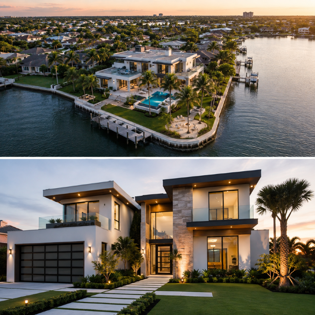
Many successful home listings now blend drone and ground photos in their galleries. Starting with an aerial view gives buyers context, while ground-level shots build the narrative room by room. Mixing both types can appeal to detail-oriented buyers as well as those who want a broad overview.
Situations where mixed photos help
Consider a property with both impressive landscaping and recently renovated interiors. Drone images will showcase the outdoor features and surroundings, while ground images allow buyers to appreciate the upgrades. Properties near water, parks, or unique environments benefit most from using both methods.